

Circular walks around Camelford
Enjoy the walks by being guided by the app


-
1.8 miles/2.9 km - Easy
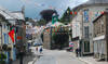
The Camelford Way

The Camelford Way
1.8 miles/2.9 km - Easy
A short and easy circular walk from Camelford along the wildflower-rich meadows of the River Camel to the clapper bridge at Fenteroon, returning through the fields with views over the Camel Valley.
-
3.9 miles/6.2 km - Easy-moderate
Stannon Moor prehistoric relics

Stannon Moor prehistoric relics
3.9 miles/6.2 km - Easy-moderate
A circular walk around Stannon Moor near St Breward with panoramic views of Bodmin Moor, passing stone circles, burial chambers and other prehistoric monuments to a massive granite boulder balanced on Louden Hill which gently rocks if you sit on it.
-
4.7 miles/7.5 km - Easy-moderate
St Teath

St Teath
4.7 miles/7.5 km - Easy-moderate
A circular walk in the countryside around St Teath where the North Cornwall Railway once ran to the bustling quarry at Delabole which provided employment for the thriving Victorian village.
-
5 miles/8.1 km - Easy-moderate
Camelford to Watergate

Camelford to Watergate
5 miles/8.1 km - Easy-moderate
A circular walk from Camelford through bluebell woods along the Camel valley to the Celtic churchyard of Advent and the Neolithic remains on the edge of Bodmin Moor.
-
6 miles/9.7 km - Easy-moderate
Three Saints Way

Three Saints Way
6 miles/9.7 km - Easy-moderate
A circular walk around the tributary valleys of the River Ottery and Kensey between three of Cornwall's least-well-known mediaeval churches
-
3.6 miles/5.8 km - Moderate
Delabole

Delabole
3.6 miles/5.8 km - Moderate
A circular walk around Delabole past the slate quarry, along back lanes and tracks, and through fields and bluebell woods.
-
5.6 miles/9 km - Moderate
Delabole to Lanteglos

Delabole to Lanteglos
5.6 miles/9 km - Moderate
A circular walk through bluebell woodland, fields and along back lanes from Delabole to Camelford's parish church at Lanteglos, returning via the Iron Age forts of Castle Goff and Delinuth Camp.
-
6.4 miles/10.3 km - Moderate
St Breward to Advent

St Breward to Advent
6.4 miles/10.3 km - Moderate
A circular walk from St Breward past the granite pillars of Devil's Jump to the 8ft Celtic cross and ancient churchyard of Advent at the foot of the moors, returning via the remains of the mediaeval village of Carwether to the Inn used by 11th century monks to build the highest church in Cornwall.
-
5.2 miles/8.4 km - Moderate-strenuous
Rough Tor and Brown Willy

Rough Tor and Brown Willy
5.2 miles/8.4 km - Moderate-strenuous
A mostly circular walk to Cornwall's two highest tors, passing prehistoric remains including the holy well, summit cairns and settlements.


Download the iWalk Cornwall app and use the QR scanner within the app to find out more about any of the walks above.
