Circular walks in Cornwall
Enjoy the walks by being guided by the app
-
4.7 miles/7.6 km - Moderate
Fowey to Polridmouth
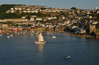
Fowey to Polridmouth
4.7 miles/7.6 km - Moderate
A figure-of-eight walk from Readymoney Cove past the Tudor fort and along the coast where Daphne du Maurier lived to Polridmouth, where the shipwreck inspired the end of her book Rebecca, and then along the mediaeval streets of Fowey.
-
6.7 miles/10.8 km - Moderate-strenuous
Polkerris, Gribbin Head and Readymoney Cove
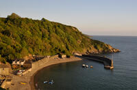
Polkerris, Gribbin Head and Readymoney Cove
6.7 miles/10.8 km - Moderate-strenuous
A circular walk near Fowey, from the tiny harbour of Polkerris, past the daymark tower on Gribbin Head and along the coast where Daphne du Maurier lived and based many of her books on, to the sandy beach at Readymoney Cove, returning on the Saint's Way.
-
4.9 miles/7.9 km - Moderate
Gorran Haven to Dodman Point
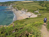
Gorran Haven to Dodman Point
4.9 miles/7.9 km - Moderate
A circular walk in the bays of Mevagissey and Veryan from the fishing village of Gorran Haven to the remote, sandy Hemmick Beach via The Deadman's Point of old nautical maps, still marked with a huge cross to warn sailors of the perilous lee shores, and Vault Beach where the wreckage washed ashore.
-
5 miles/9 km - Strenuous
Porthpean to Black Head
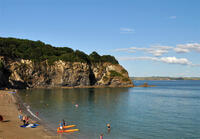
Porthpean to Black Head
5 miles/9 km - Strenuous
A circular walk from the sandy beach at Porthpean, past the brilliant white shingle beaches at Silvermine to the Iron Age fort on Black Head, returning via the site of an Iron Age metal works with spectacular views over St Austell Bay.
-
3.4 miles/5.4 km - Moderate
Mevagissey to Portmellon
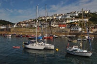
Mevagissey to Portmellon
3.4 miles/5.4 km - Moderate
A circular walk from the busy fishing port of Mevagissey into the Portmellon Valley and through the West Bodrugan Woods nature reserve to the beachside village of Portmellon where boats have been built for hundreds of years, and still are.
-
6.6 miles/10.6 km - Strenuous
Pentewan Valley and Black Head
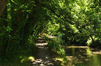
Pentewan Valley and Black Head
6.6 miles/10.6 km - Strenuous
A circular walk from the lost port of Pentewan along the coast to the remains of the Iron Age fort overlooking St Austell Bay on Black Head, returning via the nature reserve that was once the King's wood and the trackbed of the horse-drawn tramway used for china clay and Sunday School outings.
-
5.9 miles/9.6 km - Moderate
Gorran Haven to Portmellon
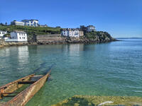
Gorran Haven to Portmellon
5.9 miles/9.6 km - Moderate
A circular walk from Gorran Haven to Portmellon via the sheer cliffs from which Henry Bodrugan leapt to escape execution and sheltered Colona Beach, returning through West Bodrugan Woods Nature Reserve and via Gorran church which now has some of the finest bells in the country.
-
5.2 miles/8.3 km - Moderate-strenuous
Nare Head to Portloe
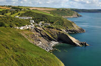
Nare Head to Portloe
5.2 miles/8.3 km - Moderate-strenuous
A circular walk around Nare Head, past the restored Cold War nuclear bunker, to the pretty fishing village of Portloe, with views along the length of The Roseland coast and over The Whelps reef - a graveyard for sailing ships that misjudged the entrance to Falmouth.
-
5.9 miles/9.5 km - Easy-moderate
St Anthony Head
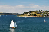
St Anthony Head
5.9 miles/9.5 km - Easy-moderate
A walk along the Roseland coast and creeks opposite St Mawes, passing the preserved fort and Fraggle Rock lighthouse on St Anthony Head and the golden sandy beaches of Molunan.
-
5.6 miles/9.0 km - Moderate
Rame Head and Cawsand
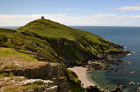
Rame Head and Cawsand
5.6 miles/9.0 km - Moderate
A circular walk around Rame Head - the southeastern corner of Cornwall - past the mediaeval chapel and the remains of a huge gun battery, now a nature reserve, on Penlee Point to Cawsand which was once the smuggling capital of Cornwall.
-
3.9 miles/6.3 km - Moderate-strenuous
Portholland to Portloe
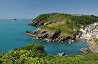
Portholland to Portloe
3.9 miles/6.3 km - Moderate-strenuous
A circular walk with lovely views of Veryan Bay to the pretty fishing village of Portloe from West Portholland, where one of the last of Cornwall's mediaeval coastal farmsteads has survived.
-
4.2 miles/6.8 km - Moderate-strenuous
Polruan to Lantic Bay
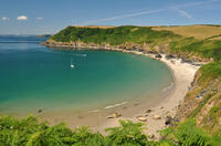
Polruan to Lantic Bay
4.2 miles/6.8 km - Moderate-strenuous
A circular walk along the coast from Polruan to the white sandy beaches of Lantic Bay, returning via Lanteglos Church and along the creek with panoramic views of Fowey.
-
4.4 miles/7.1 km - Moderate
The Lizard and Kynance Cove
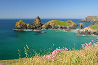
The Lizard and Kynance Cove
4.4 miles/7.1 km - Moderate
A circular walk along the Victorian Excursion route from Lizard village to the most southerly point and along the coast path to Kynance Cove with spectacular views, wildflowers, and wildlife including the Cornish Chough.
-
6.8 miles/10.9 km - Moderate-strenuous
Talland Bay to Looe
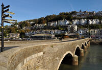
Talland Bay to Looe
6.8 miles/10.9 km - Moderate-strenuous
A circular walk along the coast from Talland Bay to Looe, passing the pilgrimage site of Looe Island which Jesus was said to have visited as a child, and returning via the ancient Giant's Hedge in Kilminorth Wood and Talland's mediaeval church.
-
4.8 miles/7.8 km - Moderate-strenuous
Mousehole to Lamorna Cove
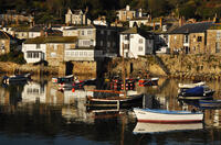
Mousehole to Lamorna Cove
4.8 miles/7.8 km - Moderate-strenuous
A circular walk following the coast from the historic fishing village of Mousehole through the Kemyel Crease nature reserve and around the towering cliffs of Lamorna Cove with views over Mount's Bay, returning along the route was that taken by the Victorian postman on his round from Penzance.
-
2.9 miles/4.7 km - Moderate
Polperro harbour and headlands
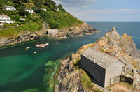
Polperro harbour and headlands
2.9 miles/4.7 km - Moderate
A figure-of-eight walk around the fishing village and headlands surrounding Polperro, passing the net loft perched above the harbour, the Victorian sea pool, the site of the mediaeval chapel and the harbourmaster's route to the lighthouse.
-
6.2 miles/10 km - Moderate
Mullion to Predannack
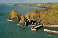
Mullion to Predannack
6.2 miles/10 km - Moderate
A circular walk passing the sandy beach at Polurrian Cove, the storm-beaten Victorian harbour at Mullion Cove, and along the cliffs of the National Nature Reserve overlooking Mullion Island, with vibrant wildflowers in spring and summer.
-
7 miles/11.3 km - Moderate
Cadgwith Cove to The Lizard
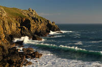
Cadgwith Cove to The Lizard
7 miles/11.3 km - Moderate
A circular walk on The Lizard from the pretty fishing hamlet of Cadgwith Cove, past the Devil's Frying Pan, lifeboat station, restored Marconi wireless hut and the infamous lighthouse, to the most southerly point, returning via two ancient churches and the holy well dedicated to the Celtic Saint accused of being a werewolf.
-
5 miles/8 km - Moderate
Lantivet Bay and Lansallos
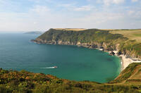
Lantivet Bay and Lansallos
5 miles/8 km - Moderate
A circular walk above the white sand crescent of Lantic Bay and the small coves of Lantivet Bay where a battle was once fought between smugglers and Customs men, and following an ancient cart track along the stream through the woods to the mediaeval church of Lansallos.
-
3.9 miles/6.3 km - Moderate
Perranuthnoe to Prussia Cove
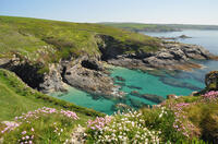
Perranuthnoe to Prussia Cove
3.9 miles/6.3 km - Moderate
A circular walk along Mount's Bay from the large sandy beach at Perranuthnoe to the smugglers' coves at Prussia Cove, returning across the fields with views over St Michael's Mount.
Download the iWalk Cornwall app and use the QR scanner within the app to find out more about any of the walks above.
